Alpine Adventure – Take 20

Alpine Adventure – Take 20
by Tom Koleszar, 18 August 2018
.

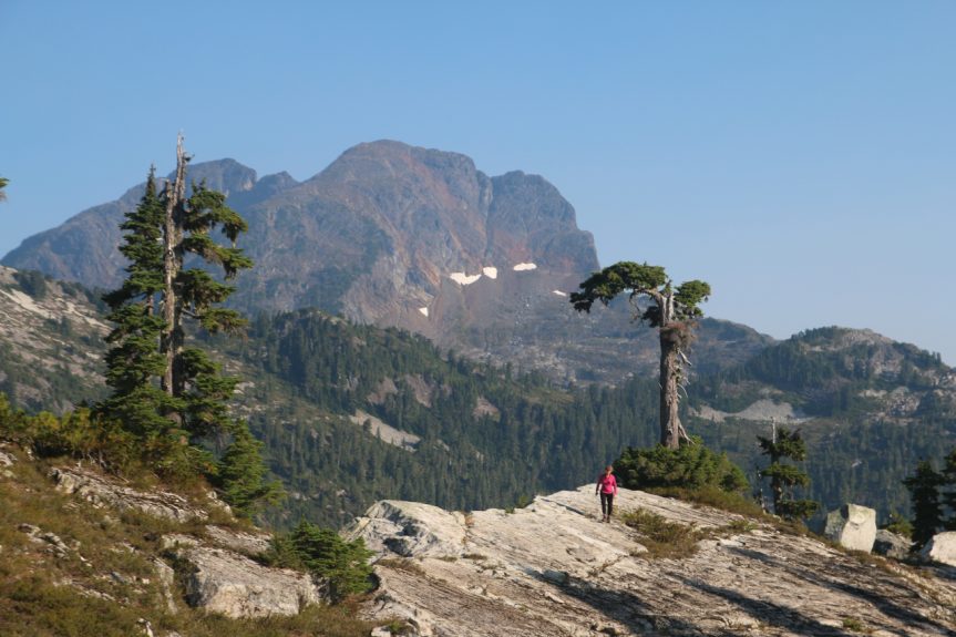
Twenty of us recently enjoyed a helicopter trip into our local alpine country.  Flying from the airport and from a staging area near Goat Lake, we spent the day on a ridge top between Diane and Joan Lakes, near Mt Baldy.  It was a great day as we were able to find a window of wonderful weather amidst all the forest fire smoke we’ve been having!

We spent the day exploring the ridge, enjoying the views, and sampling the blueberries (they were everywhere!). After everyone arrived on the ridge top, we spent the rest of the morning on a tour of the area learning about the geology, geography, shrubs, and trees, though we were a bit late for most of the wildflowers (there was some saxifrage, but most others were already done).

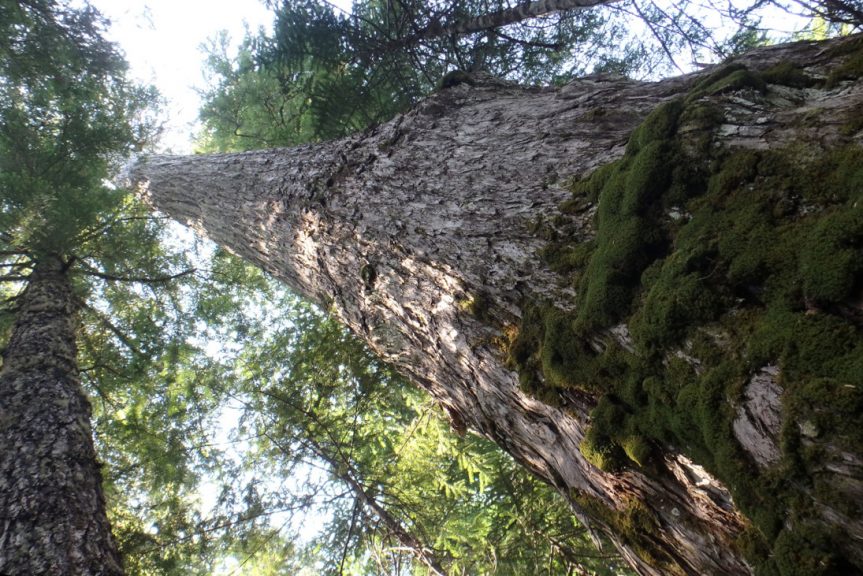
The ridge itself and the surrounding mountains provided excellent examples of the geology, including Coast Plutonic Complex diorites along with Gambier and Vancouver Group volcanic and sedimentary rocks.  Lichens and mosses were common, as were heathers, different kinds of blueberries, and rhododendrons in areas with a bit more soil.  It was obvious that the trees up there have a very hard life, but we identified lots of Mountain Hemlock and Yellow Cedar (some very old!), along with a few Subalpine Fir and an occasional Mountain Ash!

After lunch, we had some free time to explore as we wished, or just relax and enjoy a beautiful alpine day.  Our group included everyone from experienced local climbers remembering past days all the way to those seeing our alpine areas for the first time, and I think a great time was had by all!

Special thanks go to Nancy Pezel for helping with the trip, our drivers who took folks to the staging area over many kilometers of dusty roads (John Pezel, Lee Edmunds, Nancy Pezel and Simon Goede), and also to Pilot James Mode of Oceanview Helicopters for safe flying and interesting tours!

Elephant Lake old-growth

Elephant Lake old-growth
by Lois Bridger, 28 July 2018
.

Getting to the old-growth took some doing!

There were 29 of us in a convoy of vehicles driving up to an elevation of 900 metres.  Nancy and Tom led the hike along part of the Sunshine Coast Trail.  We were fortunate to also have a few knowledgeable foresters along on the hike who were happy to provide us with additional information.  We also had some visitors from Alberta and Iceland and crossed paths with some happy Sunshine Coast Trail hikers from Penticton.

We stopped at various locations as Nancy pointed out the various old-growth trees found at this elevation.  With tape measure in hand we measured a particularly large Yellow Cedar and estimated it’s age at 1500 years.  At higher elevation trees don’t grow at the same rate as they do lower down.  We learned about Sika Alders, Mountain Hemlock, Western White Pine and Pacific Silver Fir to name a few.  We saw some unusually large bracket fungi.

We paused for lunch at a flat estuary on the shore of Elephant Lake with great views of one the few remaining high elevation old-growth forests in this area.  As we dined several colourful dragonflies provided an aerial display.  In the shallows close to shore we discovered some rough-skinned newts and were entertained by their response to us.  When feeling threatened they twirl over and over displaying their bright orange underbelly.

On our return journey we took a different route offering some fantastic, albeit hazy, views of the Saltery Bay area.  A great end to a wonderful outing.

Rod Tysdal & Chris Laing – “Sustainable forests”

Rod Tysdal & Chris Laing – “Sustainable forests”
by Andrew Bryant, 20 Nov 2014. 

Professional forester Rod Tysdal, who works for the Powell River Community Forest, and Chris Laing, a forestry consultant and owner of Results Based Forest Management Limited, teamed up to provide a fascinating glimpse into the use of modern technology in order to manage our forests in a sustainable way.

While focussing on local forests, Rod and Chris also showed how forestry methods have evolved over the years throughout the province.   Long gone are the old ways of hip-chains, flagging tape and dbh tapes.  More importantly, long gone are the days of simply harvesting trees and planting Douglas fir everywhere!

Instead, using advanced remote sensing methods such as LIDAR (light detection and ranging) and combining the resulting data using modern computer-based GIS (geographic information system) software, Rod and Chris showed the astounding amount of information that can be gleaned.

Forest heights, tree species, and even branching patterns can be clearly distinguished, making it far easier to know what “what is there” and “what can be sustainably harvested”.  It also allows foresters to tailor treatments specifically for a given area, improving forest productivity and helping us to know”what it will look like” for years or even decades into the future.

Eye-popping stuff!