Our mission…to circumnavigate Cortes Island…and watch for rocks! – T. Siddall

Our vessel, the lovely Misty Isles – T. Siddall

A stunning dyke on Twin Island – T. Siddall

Pictograph – T. Siddall

Buchia fossil– T. Siddall

– T. Siddall

What rock hammers are for…isn’t it cute? – T. Siddall

A buck watches our mysterious ways – T. Siddall

Stranded moon – T. Siddall

We stayed overnight at Coast Mounatin Expedition Lodge– T. Siddall

Lanny, Ralph and Cedar-the-dog – our hosts for the night – T. Siddall

View from the lodge…the setting was wonderful! – T. Siddall

The mysterious “Lucey” grave on West Redonda Island – T. Siddall

Captain Mike and the Misty. Too soon it was time to re-embark for the voyage home – T. Siddall

Xenoliths and more! With our brains full of geological insights…and puns…and packs heavier with samples! – T. Siddall
Cortes Island geology
by Tammy Siddall, 22 July 2015.
It was a perfect July day in Lund when 12 naturalists boarded the Misty Isles in search of rocks. Captain Mike and crewmate Amy had planned an exciting two-day circumnavigation of Cortes Island for us. From Lund Harbour we first headed north towards the Twin Islands.
As we travelled, co-leaders Barbara Sherriff & Tom Kolezar spoke about the geological formations and what we hoped to find. We were on the lookout for dykes, which are sheets of igneous rock that form in fractures of existing rock. We hit the mother lode arriving on Twin, where we hopped into the zodiac to head ashore. The dykes did not disappoint!
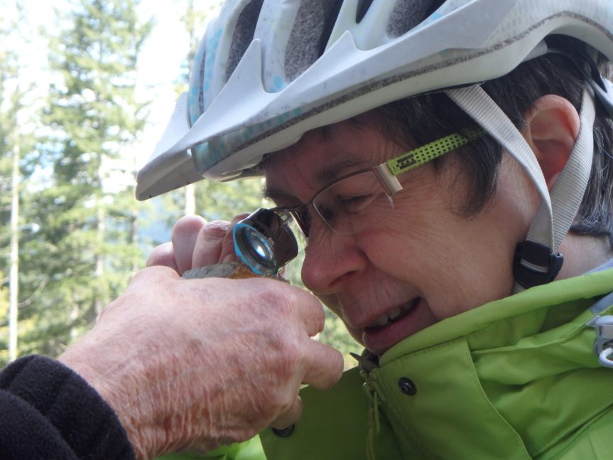
From there we headed farther northwest around Cortes as Mike spoke to the group about Buchia, which are bivalve fossils. His enthusiasm for Buchia was infectious and we followed a tip he had on a new specimen. It was a treasure hunt. We headed ashore and found the Buchia fossil. This was a hunt 140 million years in the making!
After a lovely lunch and some of the best cookies going, we travelled further around Cortes, learning the history of the region and spotting more dykes. With the informative rock lessons from our great leaders, no one on this trip will ever look at the shoreline the same way again.
An impromptu stop at Quartz Bay revealed a stunning dyke of quartz crystals. Tom and Barbara worked out that the existing rock setting in which the crystals formed was a sandstone while a foraging deer looked on. We even spotted a ‘cute’ dyke!
For the evening we headed to Read Island to stay at the Coast Mountain Expedition lodge. As we anchored in a bloom of moon jellyfish we knew we were in for something magical. The setting was serene and the hosts were marvelous. As usual, the meal was awesome. The next morning we had a lovely breakfast made by Lannie and Ralph, our lodge hosts and we were off in search of a copper and molybdenite deposit.
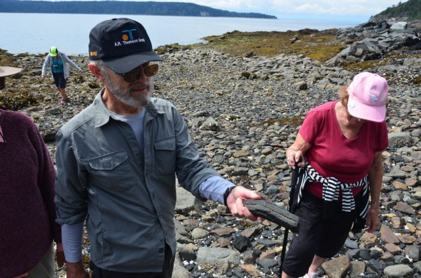
We travelled to the location of a stream that drains below a claim site on West Redonda Island. Here we came ashore and we found assorted interesting cobbles including magnetite, basalt, diorite, granodiorite, and a rich sulphide. (You know the rocks are interesting when the geologists take back samples for themselves!) Another treat at this location was the mysterious albeit beautiful gravestone belonging to two small children named Lucey. The grave is still a mystery more than 100 years later. The setting of the stream was idyllic and the water so clear that many of the group took time out to have a quick dip in the ocean.
Refreshed and renewed, we headed off in search of more ancestral pictographs. Mike once again regaled us with the history of the area, peppered like shiny mica, with the mystical stories as told by the area’s aboriginal communities. After lunch, which included more of those great cookies (thanks Samantha!) we headed south towards geological formations known as xenoliths. The xenoliths created wild patterns where they contrasted the host rock. On our way to the xenoliths, we rounded a small island, which Mike calls Mini-Mittlenatch where we spotted many sea birds along-side seals nursing their young.
When we came into the Lund Harbour after an incredible day at sea, most of us realized our bags were much heavier than when we started. Various rock samples of our treasure hunts were stuffed into our luggage.
For many of us on this trip the unfolding world of rocks was a new and tuff one, but after a fantastic two days we all agreed it was a blast!